 North Country National Scenic Hiking Trail
[NCNST] Across New York State
At present the North Country Scenic Hiking Trail has no trail map series of its own in NY State. A good way to map the nearly 670-mile distance is to divide it into three parts – west, central, and east.
- The WEST part is 420 miles of Finger Lakes trail map series that include the concurrent North Country Trail. These are official and reliable hiking maps. Order FLT maps M-1 through M-21 and O-1 and O-2 through www.fingerlakes.org (opens in a new window).
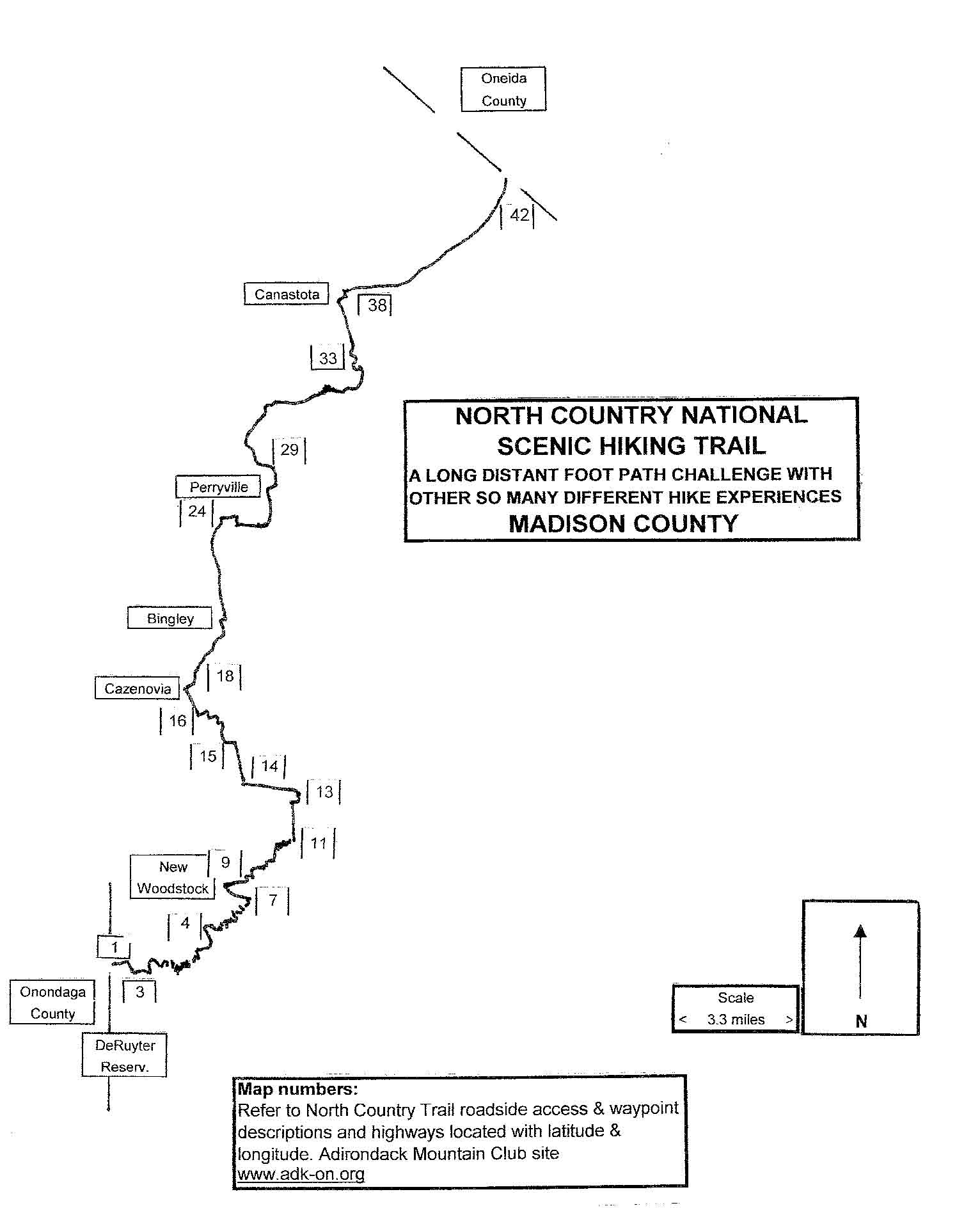
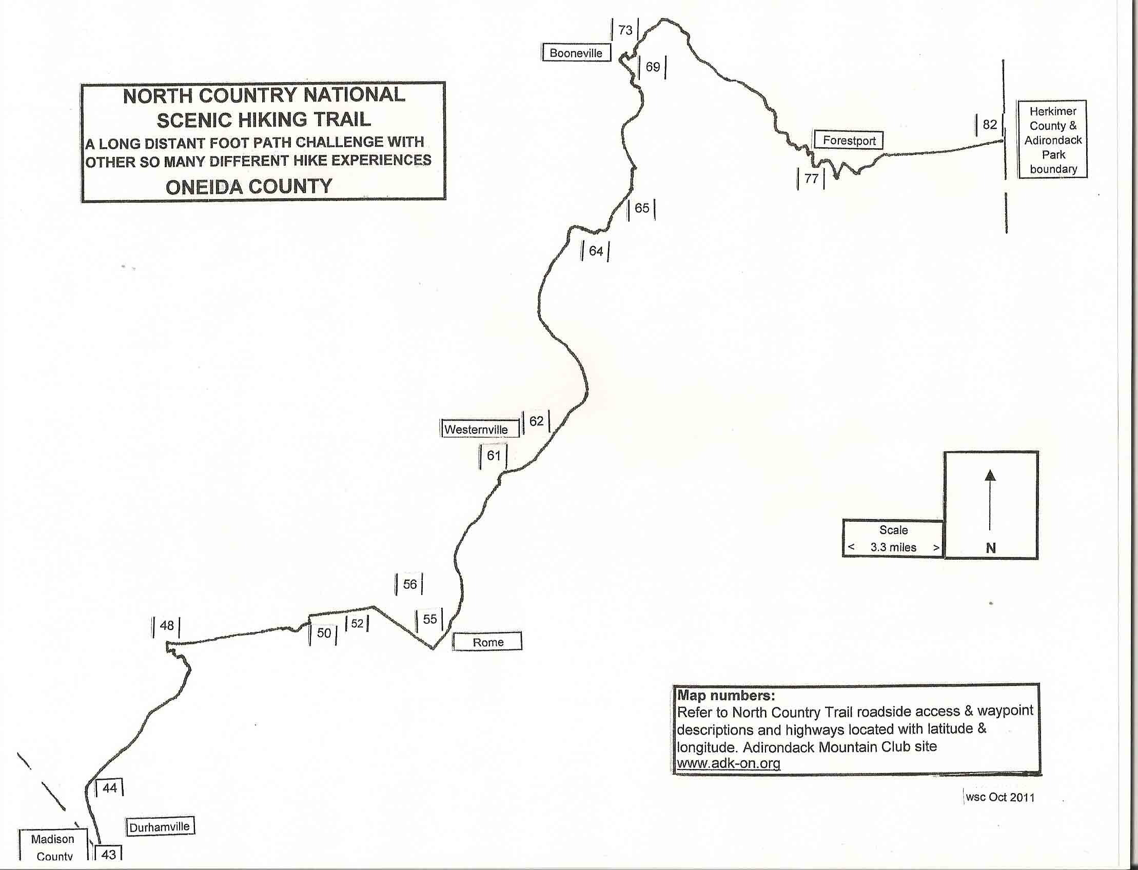
- The CENTRAL part is from where the Finger Lakes branch trail ends (just south of Nelson Swamp) to the Adirondack Park boundary. This Web site, covers this 100-mile distance by listing 80 described accesses and waypoints to the North Country Trail and approximate latitudes and longitudes. Much is on old railroad and canal paths.
- The EAST part has 150 miles inside the Adirondack boundary (Blue Line). A defined Adirondack North Country Trail track is becoming more evident from hiking travel.
PRINTING for use with road map or GPS or DOWNLOADING for a hiking map:
Madison County North Country Trail Access Coordinates Spreadsheet
Oneida County North Country Trail Access Coordinates Spreadsheet
The first footpath access, Stone Dam Lake Trail, begins 1.6 miles east of the Blue Line or 8 miles east of Forestport. The North Country Trail eastern terminus is on Crown Point on Lake Champlain. The National Park Service has recommended this corridor with the New York State Department of Environmental Conservation (DEC) in 1997.
Several hiking volunteers from the Onondaga and Schenectady Adirondack Mountain Club chapters have been reporting GPS tracking data in the corridor to North Country Trail and DEC officials. Trail construction must wait for DEC and Adirondack Park Agency clearances. Most of the route is on DEC land or easement tracts and much of it is on existing paths with reasonable road connections.
A few backpackers have already crossed the entire North Country Trail Adirondack corridor. Suggested day trip NCT Segments: Stone Dam Lake Trail, Ice Cave Valley path, Brooktrout Lake, Pillsbury Lake/French Louie Trail, Long and Rock Ponds, Kings Flow- Puffer Brook Pond, Thirteenth Lake, Kunjamuk Trail and Peaked Mountain. More segments are developing. See Adirondack Route page.
Recommended is the Adirondack Mountain Club’s National Geographic Adirondack topographic map series from www.adk.org (opens in a new window). These are suited for both latitude and longitude and the UTM navigation systems.
MCC 1/28/13, WSC 9/14/11