 NCNST Adirondack Route
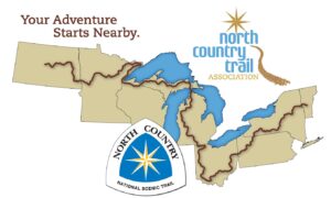
Existing Trails on the North Country National Scenic Trail (NCNST) Adirondack Route
The NCNST spans 4800 miles from North Dakota to the Appalachian Trail in Vermont. Its current features include:
- It is the longest of the 11 National Scenic Trails,
- has about 3200 miles on the ground,
- about 158 miles are planned across the Adirondack Park,
- over 80 miles exist on the trails described below, or on parts of these trails,
- about 39 miles of new trail currently exist as bushwhacks, and
- there are about 20–26 miles of temporary connectors and roads to avoid private land.
ENTER ADIRONDACK PARK
Listed from west to east after leaving Forestport and heading toward North Lake and finally Crown Point State Historic Site, NY terminus and bridge to VT.
The below trails are on the proposed route but not all are yet approved in UMPS or RMPS, constructed, or marked. At this time through hikers must use road walks that are non-NCNST routes to connect with completed sections. Bushwhacking is not recommended. For the road walk connectors map, click this link and scroll east to NY and the Adirondacks:
The 2015 Final Plan for the Adirondack route can be found at http://www.dec.ny.gov/docs/lands_forests_pdf/ncnst001.pdf
Black River Wild Forest: ADK Nat Geo Map 745
Follow North Lake Road to trailhead.
No trails in this Wild Forest are marked NCNST but some have DEC markers
Stone Dam Trail (North Lake Rd.) #84
TBA Stone Dam-Little Woodhull Connector Trail
Little Woodhull Lake Trail (North Lake Rd.) #85
Optional Loop: Little Woodhull Lake Trail–Sand Lake Falls Trail #79–North Lake Loop Rd. (8.8 miles)
TBA connector to Ice Cave Valley or
Road walk: North Lake Loop Road, unpaved to end of North Lake
Ice Cave Mtn. Trail (North Lake Rd.) Trail #87E (North Lake Tract Easement)
Optional climb: Ice Cave Mtn. (#87F)
West Canada Wilderness, Moose River Plains Primitive Area & Jessup River Wild Forest: ADK Nat Geo Map 744
Few NCNST markings but most have DEC markers
Herd path(unmarked) to Horn Lake
Indian River (Horn Lake) Trail #95A and #95 to Indian River Road (No bridge yet, crossing the Indian River can be dangerous in high water and is not recommended)
Follow Indian River Rd. to corner/turn, non motorized to Squaw Lake barrier
Brooktrout Lake Trail #50 (leanto )(Moose River Plains, Indian River Rd.)
West Lake–(leanto) #50
Northville–Placid Trail (1 mile)
Sampson–Mud Lake Trail #48
Pillsbury Lake(leanto) French Louie -Cedar Lake Trail #47 & 46
Optional climb: Pillsbury Mt. #45
Dirt logging roads: Old Military Rd. to Sled Harbor, Perkins Clearing Rd. to RT 30 crossing (NCNST markers on dirt roads and at trailheads)
Snowmobile trail from RT 30 to Oak Mt Ski Center and Elm Lake Rd. in Speculator.
Through hike now possible as of 2020: Moose River Plains Rd. south of Inlet (Rt. 28) and Otter Brook Rd., and Indian River Rd. to North Creek Ski Bowl Rt. 28 & Rt.28N
Siamese Pond Wilderness: ADK Nat Geo Map 744
Elm Lake Rd.to Cisco Creek Trail #34 marked NCNST
Kunjamuk Trail #30
Wakley Crossover Trail (not on maps yet)
Optional climb: Humphrey’s Mtn.
Kings Flow east #29
Puffer Pond Brook Trail #28
Puffer Pond Trail #23
Botheration Pond Ski Trail #22
Halfway Brook Ski Trail #17
Raymond Brook Ski Trail #18
Vanderwhacker Mountain Wild Forest: ADK Nat Geo Map 744
Raymond Brook Ski Trail #18
North Creek Ski Bowl
Road walk to North Creek, cross Hudson River on Route 28N
TBA: Moxham Mt., Fourteenth Rd., Minerva
Stony Pond and Hewitt Pond Trails (Rte. 28N & Rte. 24A) #3 , #1
TBA connector to Irishtown Snowmobile Trail
VANDERWHACKER WILD FOREST S NCT
Hoffman Notch Wilderness: ADK Nat Geo Map 743
TBA west entrance
Irishtown Snowmobile trail
TBA connector to Bailey Pond Trail
Bailey Pond Trail (Loch Muller Rd.) #107
Hoffman Notch Trail (Hoffman Rd.) #106
Big Pond Trail #105
Jones Hill Trail between Big Pond Trail and Dirgylot Trail Head (Officially marked in 2024)
Hammond Pond Wild Forest: ADK Nat Geo Map 743
Cross Schroon River on road bridge
Enter State land
Cross Johnson Pond Rd.(unpaved)
Moose Mtn. Pond Trail (Ensign Rd.) Trail #4, via Berrymill Brook
TBA connector trail
Bloody Pond Trail (Ensign Rd.) Trail #5, via Hammond Pond
Optional climb: Bloody Mtn. bushwhack ~1+ mile
RMP needed on Lyme Timber private lands
Road walks to Crown Point State Historic Site, New York State terminus and Lake Champlain Bridge to Vermont.
For road walk connectors map, check this link and scroll east to NY and Adirondacks:: http://nct.maps.arcgis.com/apps/Viewer/index.html?appid=23a2c0d674cb443ea9835af2e8c5f13a
Considerations before undertaking a trip:
- Much of the route is a remote wilderness route for the experienced hiker only who is familiar with both map and compass and GPS. Day hiking is possible near trailheads. Do not hike alone. Do not overestimate your ability based on other hiking experiences. Plan on backpacking overnight(s).
- Hike at your own risk with ADK guidebooks, ADK National Geographic Maps # 743, 744, 745, compass and GPS with extra batteries, the usual survival gear (cell phone reception is spotty) and overnight equipment (i.e. tent, sleeping bag, food in bear proof container, stove, water treatment tablets/filter, appropriate extra clothing to keep you warm and dry). Thoroughly heed all caveats listed in the ADK guidebooks.
- Tell someone where you are going, and give them your daily itinerary and expected return. Sign in at trail registers, and stick to your plan.
- On bushwhack routes between marked trails as well as on marked trails, you may encounter uneven ground, overgrown brush, blowdowns, beaver dams, bogs, and challenging stream crossings. Avoid winter and early spring outings.
- Some trails on maps, in ADK guidebooks and ADK National Geographic Maps are not well maintained or are merely herd paths or volunteer paths and are sparsely marked if at all.
- GPS routes and waypoints are approximate. Hikers should hike in groups of at least 3–4, and in Wilderness Areas, no more than 9 are permitted. Use stoves not fires, camp 150 feet from the trail or water unless marked as a designated campsite, and employ Leave No Trace ethics. Do not camp on any private lands.
- Check the NYS DEC website for trail condition updates and current emergency phone numbers.
- Practice Leave No Trace principles.
Updated 1/1/2025 RFR